Jal Prahari
Autonomous vessels that measure the river as it actually flows.
A solar-hybrid surface vessel for Indian rivers. It dips a multi-parameter cage below the surface film for valid chemistry, and profiles current with ADCP — acoustic beams through the water column. Those streams bind to the hydro-ontology so flood routing, discharge, and quality forecast stay honest.
Request a briefing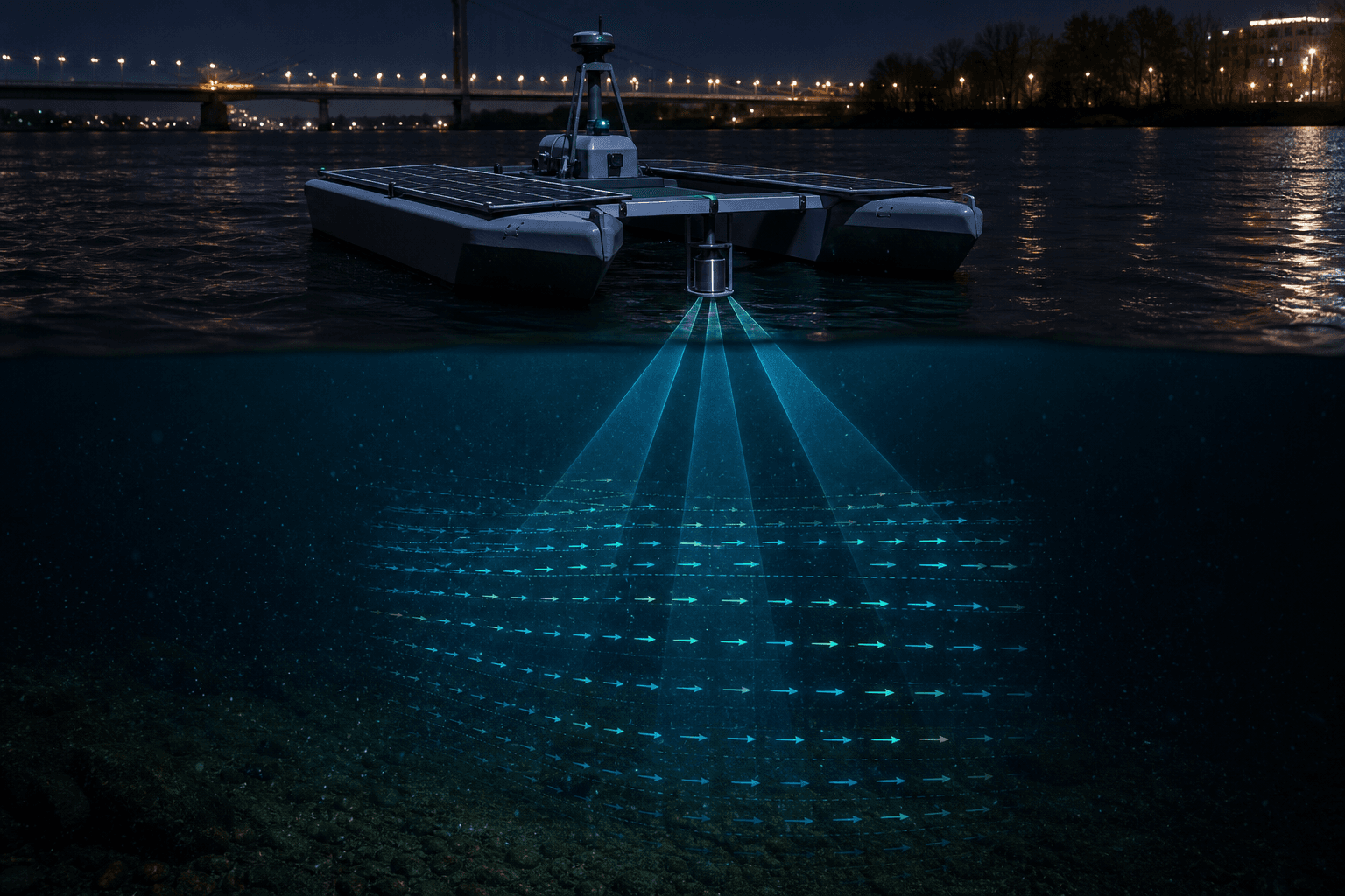
Why ADCP belongs on the vessel
Stage gauges tell you height. Satellites tell you extent. ADCP tells you how the water is moving — velocity through the column. From that, the twin gets discharge and how fast a flood wave will travel. Without it, hydrology models are guessing. Jal Prahari takes the instrument to the reach that matters, on a schedule the twin can ingest continuously.
What the platform carries
ADCP current profiles
Acoustic Doppler beams sample velocity through the water column — the missing observation for discharge, flood routing, and model calibration.
Sub-surface quality
An active-dipping cage reads pH, dissolved oxygen, turbidity, conductivity, temperature, and related parameters beneath the surface film.
Persistent presence
Solar-electric primary power with battery reserve for multi-day autonomous missions along a reach or around an outfall.
River-rated hull
Twin-hull catamaran, field-run on the Godavari and the Ganga, including monsoon-active conditions.
Onboard inference
Edge compute for navigation, debris awareness, and annotated video that travels with the telemetry.
Twin-native telemetry
Time-stamped, geo-aligned streams that bind to ontology entities — a reach, a cell, a city drain — rather than sitting in a silo.
Jal Prahari
| Displacement | ≈ 45 kg |
|---|---|
| Cruise | 4 knots |
| Endurance | Multi-day autonomous |
| Hull | Twin-hull catamaran, composite |
| Current sensing | ADCP water-column velocity profiles |
| Water quality | Multi-parameter cage, sub-surface dip |
| Power | Solar primary, battery reserve |
| Compute | Onboard edge AI |
| Navigation | Waypoint autonomy with manual fallback |
| Comms | Cellular with satellite fallback |
| Field status | Godavari and Ganga deployments |
Contact
Request a briefing.
For basin operators, city agencies, and partners who need a living model of water — not another static map.
- Vishal@aurixys.com
- +91 70384 86909
- LinkedIn — Vishal Patil
- Nashik, Maharashtra, India